
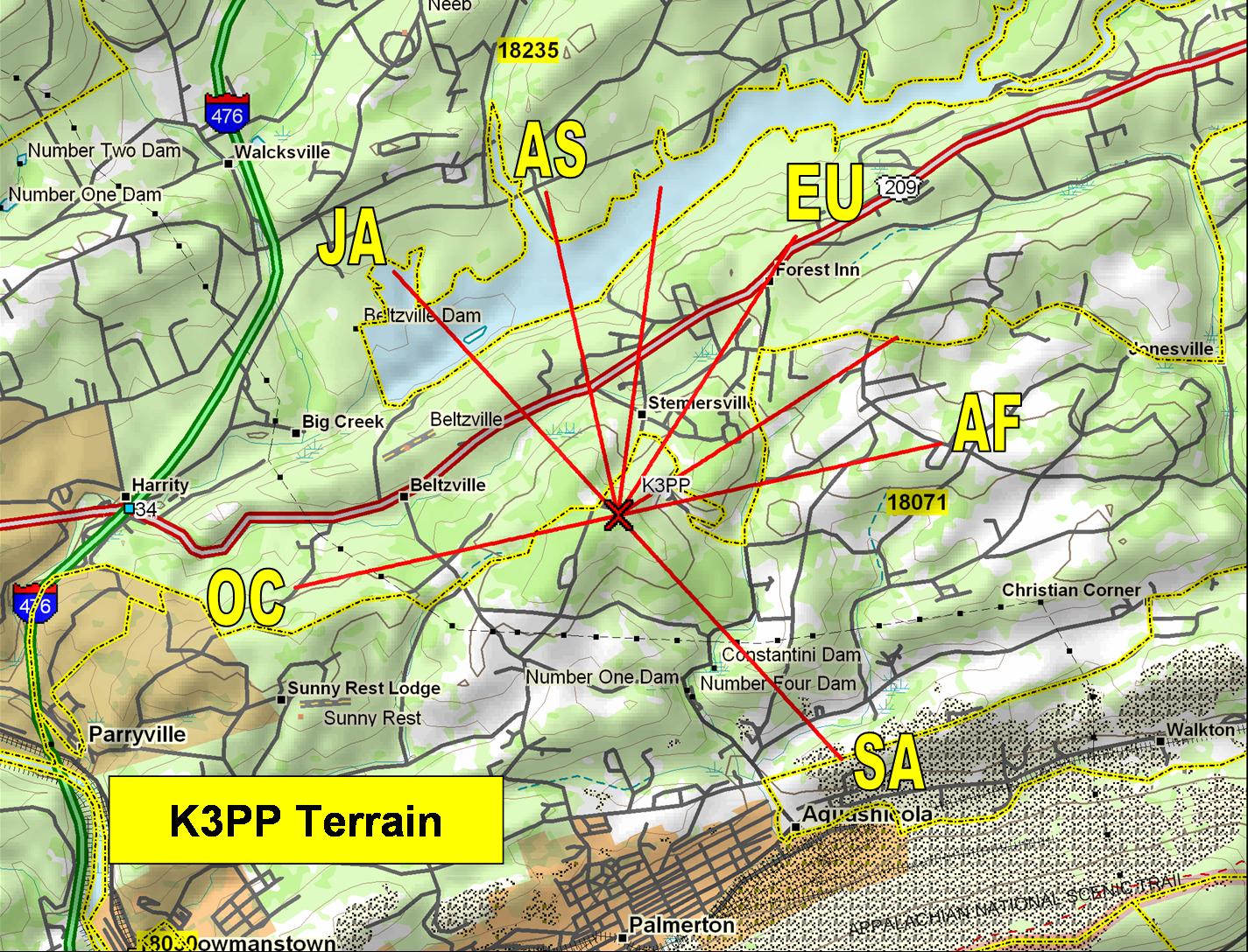
K3PP's QTH
The K3PP station is at 40° 50' 48"N -75° 36' 38" W atop a hill at 1129 ft above sea level. It is a great radio location that has proven itself in numerous contests and DX pileup conquests. My antennas are good, but this QTH enables me to perform as if I had a huge antenna farm. With a relatively modest station, I can lock horns with the big boys and often come out on top.
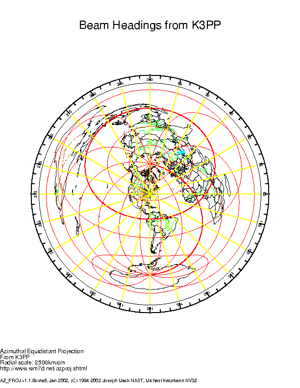
This map shows my specific location and the beam headings for the important contesting locations of the world. Click on the map for a (very) large copy of the map. I generated this using Delorme's excellent Topo USA mapping software.
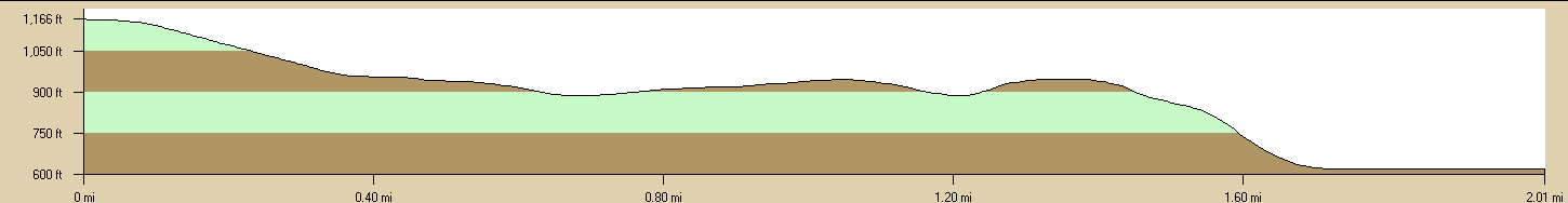
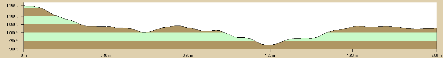
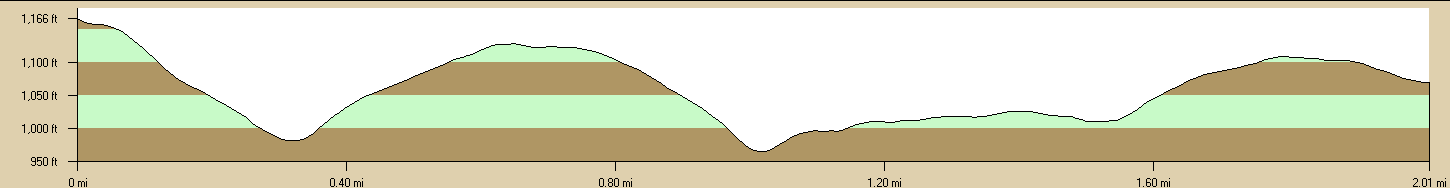
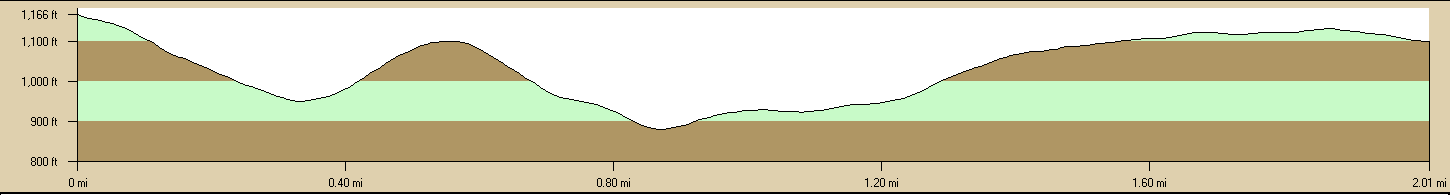
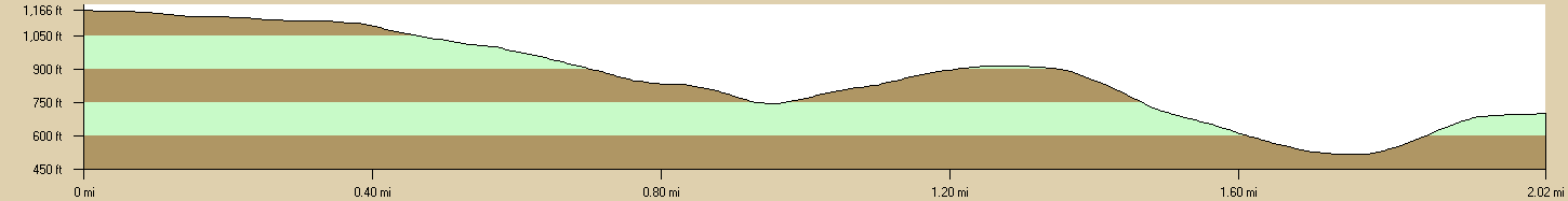
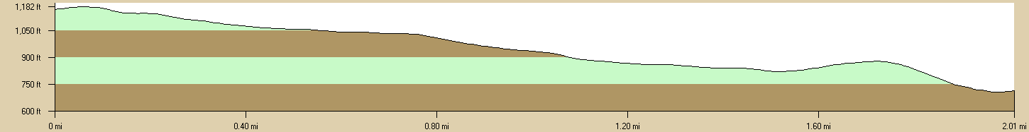
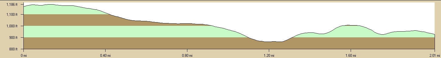
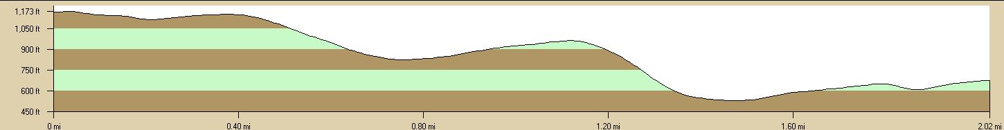
Terrain Profiles
Also using Topo USA, I am also able to draw the terrain profiles for each beam heading. As you can see, all directions are downhill. Click on any profile image for the full size image.
(0° Heading) Southeast Asia/China

(20° Heading) Northern Europe/Central Asia
(45° Heading) Europe/Middle East
(70° Heading) Southern Europe/Northern Africa
(90° Heading) Central Africa
(150° Heading) South America/Caribbean
(220° Heading) East Australia/New Zealand/South Pacific
(270° Heading) Central Pacific (e.g., KH6, V6, , KH2)
(330° Heading) Japan/Alaska
Great Circle Map
The follwing map was generated by the teriffic AZ-PROJ software developed by Joe Mack NA3T
Terrain Analysis
I am an old engineer, so I find great value in software modeling. I've dabbled a bit with VEC variants for antenna modeling, but I became very interested in the terrain effects on propagation. Given my nice hilltop QTH, I thought I'd try to evaluate my antenna choices and what I could plan for future expansion to improve my performance. Here are the results.
One of the best values in amateur radio is the ARRL Antenna Book, for two reasons. First, it is the finest and richest treasure trove of useful information about all aspects of antennas. If all hams have one common denominator, it is the antenna. None of us can transmit without one, even if it's as bizarre as the light bulb that N6BT tried. The second reason is that the more recent editions of the books come with a great collection of software. One of my favorite toys on the CDROM is the HFTA program for terrain analysis.
I began my terrain analysis with the TA program that was in a previous edition. It was the predecessor to HFTA. HFTA is far superior, especially in conjunction with the MICRODEM software developed by the U.S. Navy and offered for free. In TA, the terrain data had to be entered manually, which was cumbersome and subject to errors. MICRODEM helps automate this, by extracting the terrain data from topographic map data files, also available for free.
|
Click on the Earth Icon for the Modeled Results for that Band and Destination
|
|||||||||
| Destination | Heading | 80m | 40m | 30m | 20m | 17m | 15m | 12m | 10m |
| Asia | 0° | ||||||||
| Europe | 45° | ||||||||
| Africa | 90° | ||||||||
| South America | 150° | ||||||||
| Oceania | 270° | ||||||||
| Japan | 330° | ||||||||